By Tony Bandy
When’s the last time you used a paper map? More than likely it’s been a while.
Smartphones and browser-based geographical applications have, for many of us, replaced the physical maps we once so heavily relied on. However, our ancestors did not have the luxury of this technology and so they depended exclusively on paper maps for a wide variety of purposes. One such use that often seems long forgotten was for fire insurance purposes!
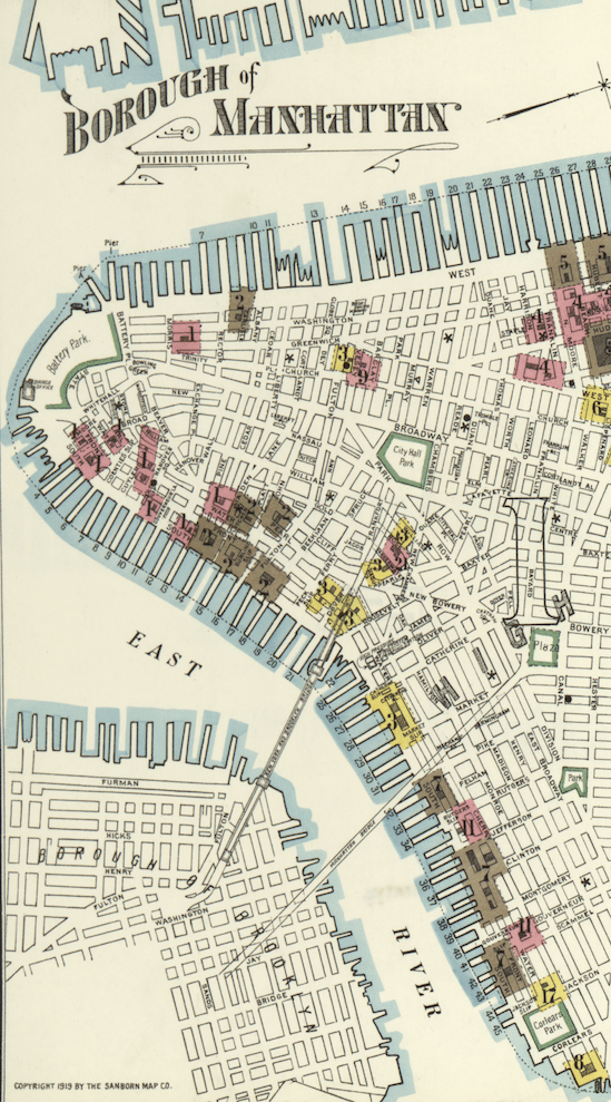
Surprisingly enough, these types of maps were used extensively by many public and private insurance companies to determine whether or not applicants, and their respective properties, were good or bad insurance risks. Although not really in use today these documents were highly popular in the years following the American Civil War and up through (at least) the middle part of the 20th Century.
What makes these maps unique is that they were not just geographic in nature. They also included a wealth of information and details on city and populations, personal and family names, building composition, and community infrastructure – perfect for better understanding your ancestors’ communities so that you can uncover more details about their lives.
The Sanborn Map Company was one of the most popular mapping companies of the day, and it is these very maps that we now have available to us online for our family research. Digitized by the Library of Congress and other institutions, you will find information on over 12,000 cities and other communities through these amazing maps.
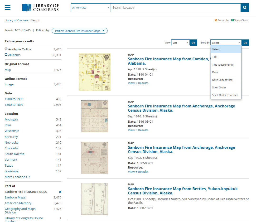
While subsets of these physical maps have been digitized over the years and can be found in various places throughout the Internet, the best place to get started with them for your family research is via the Library of Congress, at the main Library of Congress digital collection of Sanborn maps.
At this main page you will find an overview of the library’s online collection, as well as search options, additional bits and pieces, and essays on the maps themselves. If you have never used these resources before it’s worth it to take a quick look around in order to gather background information and details. Here are a few places to start:
However, the real power behind this collection will come when you start examining the over 3,400 digital maps available.
You can use the search box at the top of the collection page to look for a specific city or location – or use the ‘Collection Items’ link to gain a broad overview of the entire contents: which you can then break down via format, date, location, and other metadata options.
Once you have found a map or series of maps that you think might be useful to your family history research, what’s the next step?
To quickly examine singular results, you can use the viewer embedded on the results page to view the map in question (you will find the included viewing controls quite easy to use). Once you are ready to download (yes, they are available for download!) there are various formats available including GIF, JPEG, TIFF, or the newer JPEG 2000 format.
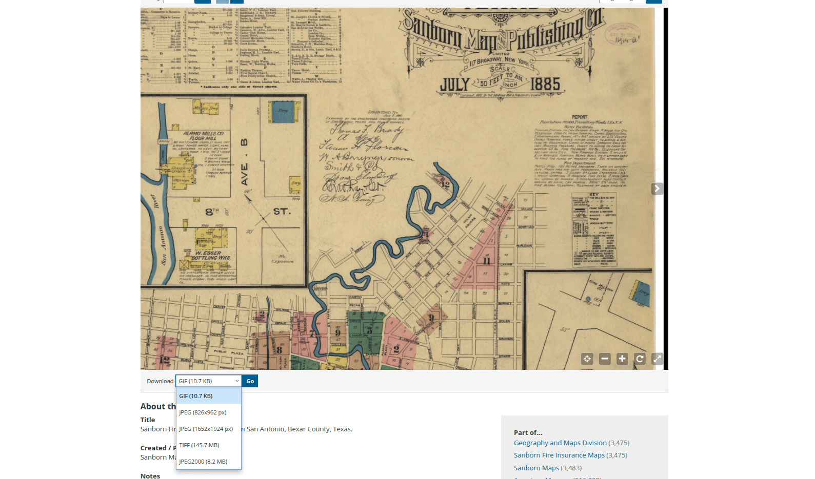
Your chosen format will depend a lot on how you plan to use these resources for your family research. TIFF is the best format, being uncompressed and great for archival or long-term storage. For ease of use and sharing the standard JPEG format is best. The GIF format is the smallest and probably not the best for either long-term storage or sharing, but instead good only for quick viewing. You can read more about digital file types here.
Now that we’ve had an opportunity to see what Sanborn maps the Library of Congress has to offer, are there other sources of information for Sanborn maps online? For a broad overview, start first at the related resources link at the Library of Congress:
From there, you can also try the Michigan State University Research Guide, or visit the online page for the Earth Sciences & Map Library at the University of California Berkeley which has outbound links and bibliographies available.
For genealogists of all types, maps – especially historic maps – can be valuable treasure troves of information. The Sanborn maps and all the wonderful insight they can provide may prove to be quite useful in your family research endeavors.
Freelance writer, family researcher, and librarian/historian, Tony Bandy can be found at Adventures in History.
The collection is not complete by any means. When will it be?
I tried to download the Massachusetts maps which are held at Harvard. You need a Harvard ID to see them.